Many folks would like to see us back on the Moon and developing its resources.

Tuesday, June 30, 2009

First Conclusive Signature For Lunar Uranium

Larry Klaes passed to fpspace and I, this information and link.

http://www.moondaily.com/reports/First_Conclusive_Signature_For_Lunar_Uranium_999.html
-----------------------------------------------------------------------------
First Conclusive Signature For Lunar Uranium

In addition to uranium, the Kaguya GRS data also is showing clear signatures for thorium, potassium, oxygen, magnesium, silicon, calcium, titanium and iron. Reedy and his colleagues are using measurements from the Kaguya lunar orbiter's GRS to construct high-quality maps of as many chemical elements as possible. Kaguya was launched in September 2007 and crashed into the Moon at the end of its mission on June 10 of this year.

Tucson AZ (SPX) Jun 30, 2009

Robert C. Reedy, a senior scientist at the Tucson-based Planetary Science Institute, is mapping the Moon's surface elements using data gathered by an advanced gamma-ray spectrometer (GRS) that rode aboard the Japanese Kaguya spacecraft.

The data promise to show chemical elements on the Moon that have never been identified before, and Reedy and the Kaguya GRS team already have found uranium signatures in the data, an element not seen in previous Moon-mapping efforts.

The uranium results were recently announced in papers presented at the 40th Lunar and Planetary Conference and at the Proceedings of the International Workshop Advances in Cosmic Ray Science. The lead authors on those papers are Prof. Naoyuki Yamashita and Prof. Nobuyuki Hasebe respectively. Both are from Japan's Waseda University.

Full article here:

http://www.moondaily.com/reports/First_Conclusive_Signature_For_Lunar_Uranium_999.html

-----------------------------------------------------------------------------

As did SpaceWarper this link.

-----------------------------------------------------------------------------
Uranium on Luna:

http://www.spaceref.com/news/viewpr.html?pid=28605
First Conclusive Signature for Lunar Uranium

PRESS RELEASE
Date Released: Monday, June 29, 2009
Source: Planetary Science Institute

Robert C. Reedy, a senior scientist at the Tucson-based Planetary Science Institute, is mapping the Moon's surface elements using data gathered by an advanced gamma-ray spectrometer (GRS) that rode aboard the Japanese Kaguya spacecraft
.
-----------------------------------------------------------------------------

Planetary Science Institute
http://www.psi.edu/

Press Releases
http://www.psi.edu/press/

If not enough Helium 3 for fission reactors, maybe ordinary old Uranium to fuel reactors we already have.
- LRK -


Thanks for looking up with me.

Larry Kellogg

Web Site: http://lkellogg.vttoth.com/LarryRussellKellogg/
BlogSpot: http://kelloggserialreports.blogspot.com/
RSS link: http://kelloggserialreports.blogspot.com/atom.xml
Newsletter: https://news.altair.com/mailman/listinfo/lunar-update
Twitter: http://twitter.com/lrkellogg
==============================================================
See Selene.jaxa website for graph images. - LRK -
-----------------------------------------------------------------------------------------
http://wms.selene.jaxa.jp/selene_viewer/en/observation_mission/grs/grs_000.html
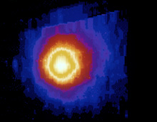
The KAGUYA Gamma-Ray Spectrometer (GRS), which employs a high-purity Ge semiconductor detector, is observing the distribution of element concentrations (K, Th, U, O, Mg, Al, Si, Ca, Ti, and Fe) in the lunar subsurface with its spatial resolution of approximately 135 km.
In the left figure, an energy spectrum of gamma rays observed by the KAGUYA GRS (red line) is shown with one observed by the GRS of Lunar Prospector (blue line), which is a past American lunar mission. The figure is plotted with counting rates of gamma rays as a vertical axis and energies of gamma rays as a horizontal axis, and the individual peaks indicate the existence of elements. As seen from the comparison of these two energy spectra, the energy spectrum measured by the KAGUYA GRS shows much sharper peaks, because of its excellent energy resolution of the KAGUYA GRS. It is clear that the KAGUYA GRS provides more detail information on elements than the Lunar Prospector GRS. The data of the KAGUYA GRS used in the figure were obtained from December 2007 (when its regular observation began) through February 2008, and the data of the Lunar Prospector GRS were from December 1998 through July 1999.
snip
==============================================================

WHAT THE MIND CAN CONCEIVE, AND BELIEVE, IT WILL ACHIEVE - LRK

==============================================================

Monday, June 29, 2009

NASA, Japan Release Most Complete Topographic Map of Earth

NASA, Japan Release Most Complete Topographic Map of Earth

A combined effort and a great product.
Good example of what could take place on the Moon.
- LRK -

----------------------------------------------------------------------------------------
http://www.nasa.gov/home/hqnews/2009/jun/HQ_09-150_ASTER_Topographic_Map.html
RELEASE : 09-150
NASA, Japan Release Most Complete Topographic Map of Earth

WASHINGTON -- NASA and Japan released a new digital topographic map of Earth Monday that covers more of our planet than ever before. The map was produced with detailed measurements from NASA's Terra spacecraft.

The new global digital elevation model of Earth was created from nearly 1.3 million individual stereo-pair images collected by the Japanese Advanced Spaceborne Thermal Emission and Reflection Radiometer, or ASTER, instrument aboard Terra. NASA and Japan's Ministry of Economy, Trade and Industry, known as METI, developed the data set. It is available online to users everywhere at no cost.

"This is the most complete, consistent global digital elevation data yet made available to the world," said Woody Turner, ASTER program scientist at NASA Headquarters in Washington. "This unique global set of data will serve users and researchers from a wide array of disciplines that need elevation and terrain information."
snip
----------------------------------------------------------------------------------------

I hope we see something like this for the Moon.

Thanks for looking up with me.

Larry Kellogg

Web Site: http://lkellogg.vttoth.com/LarryRussellKellogg/
BlogSpot: http://kelloggserialreports.blogspot.com/
RSS link: http://kelloggserialreports.blogspot.com/atom.xml
Newsletter: https://news.altair.com/mailman/listinfo/lunar-update
Twitter: http://twitter.com/lrkellogg
==============================================================
http://www.nasa.gov/home/hqnews/2009/jun/HQ_09-150_ASTER_Topographic_Map.html
June 29, 2009

Steve Cole
Headquarters, Washington
202-358-0918
stephen.e.cole@nasa.gov

Alan Buis
Jet Propulsion Laboratory, Pasadena, Calif.
818-354-0474
alan.buis@jpl.nasa.gov

RELEASE: 09-150

NASA, JAPAN RELEASE MOST COMPLETE TOPOGRAPHIC MAP OF EARTH

WASHINGTON -- NASA and Japan released a new digital topographic map of
Earth Monday that covers more of our planet than ever before. The map
was produced with detailed measurements from NASA's Terra spacecraft.

The new global digital elevation model of Earth was created from
nearly 1.3 million individual stereo-pair images collected by the
Japanese Advanced Spaceborne Thermal Emission and Reflection
Radiometer, or ASTER, instrument aboard Terra. NASA and Japan's
Ministry of Economy, Trade and Industry, known as METI, developed the
data set. It is available online to users everywhere at no cost.

"This is the most complete, consistent global digital elevation data
yet made available to the world," said Woody Turner, ASTER program
scientist at NASA Headquarters in Washington. "This unique global set
of data will serve users and researchers from a wide array of
disciplines that need elevation and terrain information."

According to Mike Abrams, ASTER science team leader at NASA's Jet
Propulsion Laboratory in Pasadena, Calif., the new topographic
information will be of value throughout the Earth sciences and has
many practical applications. "ASTER's accurate topographic data will
be used for engineering, energy exploration, conserving natural
resources, environmental management, public works design,
firefighting, recreation, geology and city planning, to name just a
few areas," Abrams said.

Previously, the most complete topographic set of data publicly
available was from NASA's Shuttle Radar Topography Mission. That
mission mapped 80 percent of Earth's landmass, between 60 degrees
north latitude and 57 degrees south. The new ASTER data expands
coverage to 99 percent, from 83 degrees north latitude and 83 degrees
south. Each elevation measurement point in the new data is 98 feet
apart.

The ASTER data fill in many of the voids in the shuttle mission's
data, such as in very steep terrains and in some deserts," said
Michael Kobrick, Shuttle Radar Topography Mission project scientist
at the Jet Propulsion Laboratory. "NASA is working to combine the
ASTER data with that of the Shuttle Radar Topography Mission and
other sources to produce an even better global topographic map."

NASA and METI are jointly contributing the ASTER topographic data to
the Group on Earth Observations, an international partnership
headquartered at the World Meteorological Organization in Geneva,
Switzerland, for use in its Global Earth Observation System of
Systems. This "system of systems" is a collaborative, international
effort to share and integrate Earth observation data from many
different instruments and systems to help monitor and forecast global
environmental changes.

NASA, METI and the U.S. Geological Survey validated the data, with
support from the U.S. National Geospatial-Intelligence Agency and
other collaborators. The data will be distributed by NASA's Land
Processes Distributed Active Archive Center at the U.S. Geological
Survey's Earth Resources Observation and Science Data Center in Sioux
Falls, S.D., and by METI's Earth Remote Sensing Data Analysis Center
in Tokyo.

ASTER is one of five Earth-observing instruments launched on Terra in
December 1999. ASTER acquires images from the visible to the thermal
infrared wavelength region, with spatial resolutions ranging from
about 50 to 300 feet. A joint science team from the U.S. and Japan
validates and calibrates the instrument and data products. The U.S.
science team is located at NASA's Jet Propulsion Laboratory.

For visualizations of the new ASTER topographic data, visit:
http://www.nasa.gov/topics/earth/features/20090629.html

Data users can download the ASTER global digital elevation model at:
https://wist.echo.nasa.gov/~wist/api/imswelcome

and

http://www.gdem.aster.ersdac.or.jp

For more information about NASA and agency programs, visit:
http://www.nasa.gov
-end-

To subscribe to the list, send a message to:
hqnews-subscribe@mediaservices.nasa.gov

==============================================================

WHAT THE MIND CAN CONCEIVE, AND BELIEVE, IT WILL ACHIEVE - LRK

==============================================================

LRO Becomes Luney Oriented

Lead the runner, throw the ball, hope it is caught.
Lead the Moon in its orbit, slow a bit upon nearing, hope the Moon's gravitational pull will whip you around in an elliptical orbit and not fling you out around the Sun.

Too slow, maybe not there. There and slowing too much and maybe plow into the Moon. Off on your target and just go whizzing by.

Not all that easy when it was done with pencil and paper and a slip stick. Easier with computer programs that help with the math. (saves on erasers)

Still you tend to hold your breath for a few days. Then there will be the orbit adjustments to circularize and ensure you are in the orbit you expected. Now do all the instruments work?

We did it with Lunar Prospector and now LRO is there to join those that have already arrived for this new season of exploration and hopefully cooperation.
See LUNAR PROSPECTOR MISSION DESIGN AND TRAJECTORY SUPPORT.
AAS98-323 (387kb PDF file)
http://lunar.arc.nasa.gov/project/pdf/AAS98-323.pdf
- LRK -

-------------------------------------------------------------------
http://www.satnews.com/cgi-bin/story.cgi?number=364119282
LRO Becomes Luney Oriented
June 29, 2009
Engineers at NASA's Goddard Space Flight Center in Greenbelt, Maryland, confirmed the spacecraft's lunar orbit insertion at 6:27 a.m. EDT last Tuesday. During transit to the moon, engineers performed a mid-course correction to get the spacecraft in the proper position to reach its lunar destination. Since the moon is always moving, the spacecraft shot for a target point ahead of the moon. When close to the moon, LRO used its rocket motor to slow down until the gravity of the moon caught the spacecraft in lunar orbit. A series of four engine burns over the next four days placed the satellite into its commissioning phase orbit. During the commissioning phase, each of its seven instruments will be checked out and brought online. The commissioning phase will end approximately 60 days after launch, when LRO will use its engines to transition to its primary mission orbit. For its primary mission, LRO will orbit above the moon at about 31 miles, or 50 kilometers, for one year. The spacecraft's instruments will help scientists compile high resolution, three-dimensional maps of the lunar surface and also survey it at many spectral wavelengths. The satellite will explore the moon's deepest craters, examining permanently sunlit and shadowed regions, and provide understanding of the effects of lunar radiation on humans. LRO will return more data about the moon than any previous mission.
-------------------------------------------------------------------

and from NASA. - LRK -

-------------------------------------------------------------------
http://lunar.gsfc.nasa.gov/
June 29 - A series of activities have been completed which have put LRO in lunar nadir pointing mode. The solar array is now tracking the sun and the spacecraft is flying with the +Z axis (instrument bore sight direction) looking down at the lunar surface. Now we can begin performing the High Gain Antenna and Gyro calibrations.

LRO initiated LOI-5 which was a 230.8 second burn (36 m/s) on Saturday. This placed LRO in a 31x199km 90.2 degree inclination polar orbit. The rocket burns initiated by controllers at NASA's Goddard Space Flight Center in Greenbelt, Md., have helped the moon capture LRO into orbit, which arrived after a five-day journey.

LRO begins its primary mission of mapping the lunar surface to find future landing sites and searching for resources that would make possible a permanent human presence on the moon.
-------------------------------------------------------------------

and - want to know where LRO is?
http://lroc.sese.asu.edu/whereislro/

If you see something of interest with LRO, let me know.

Thanks for looking up with me.

Larry Kellogg

Web Site: http://lkellogg.vttoth.com/LarryRussellKellogg/
BlogSpot: http://kelloggserialreports.blogspot.com/
RSS link: http://kelloggserialreports.blogspot.com/atom.xml
Newsletter: https://news.altair.com/mailman/listinfo/lunar-update
Twitter: http://twitter.com/lrkellogg
==============================================================
http://www.nasa.gov/mission_pages/LRO/main/index.html
LRO Reaches Commissioning Orbit

Mon, 29 Jun 2009 11:43:59 AM PDT

The final rocket burn that put the Lunar Reconnaissance Orbiter into its
commissioning orbit around the moon was completed Saturday, June 27.

While LRO is in this temporary orbit, engineers will activate and test
the spacecraft's instruments.
snip
==============================================================
http://www.nasa.gov/mission_pages/LRO/news/water_search.html
Treasure Hunting on the Moon: LRO and the Search for Water
10.02.08

A bottle of one of the most expensive brands of water costs $40, and is presented in a frosted glass container decorated with crystal. On the moon, a bottle of water would run about $50,000, and forget about that heavy crystal glass. That's because it costs around $50,000 per pound to launch anything to the moon. Discovering water on the moon would be like finding a gold mine.

In fact, scientists have discovered evidence for water or hydrogen, a component of water, in special places on the moon. Since the moon is not tilted much from its rotation axis, the depths of certain craters in the lunar poles may not have seen the sun for billions of years. The long night over these areas, called Permanently Shaded Regions (PSRs), will have made them very cold, and able to trap hydrogen or water molecules as ice.
snip
==============================================================

WHAT THE MIND CAN CONCEIVE, AND BELIEVE, IT WILL ACHIEVE - LRK

==============================================================

The lost NASA tapes: Restoring lunar images after 40 years in the vault

Jeff Marraccini, Director, Computer Systems, Altair Engineering, Inc.
http://www.altair.com/ sent me the below link and it brought back memories
of NASA Ames and my getting coffee and a bagel at McDonald's on my walk into
Ames. Now no Navy Exchange and McDonalds' is McMoon's.

We are coming up on 40 years since we first landed men on the Moon and it is
a good reminder that we need to preserve the data from missions past for
those who come later and might want to look at the old data in the light of
new technology.

I am guilty of watching old 1 inch magnetic tapes from the Pioneer Venus
missions being thrown out because they were contaminated by sewer backups in
the basement of the building I worked in. Who would want to watch TV
interviews of what was found on Venus?

Take a look at the link below. It is an interesting article. Hope you have
the time to read.
- LRK -

---------------------------------------------------------------------
The lost NASA tapes: Restoring lunar images after 40 years in the vault
http://www.computerworld.com/action/article.do?command=viewArticleBasic&articleId=9134771
A Mac Pro and 40-year-old tape drives are helping restore the original Lunar
Orbiter tapes
By Lamont Wood
June 29, 2009 12:01 AM ET

Computerworld - Liquid nitrogen, vegetable steamers, Macintosh workstations
and old, refrigerator-size tape drives. These are just some of the tools a
new breed of Space Age archeologists is using to sift through the digital
debris from the early days of NASA, mining the information in ways
unimaginable when it was first gathered four decades ago.

At stake is data that could show Earth's risk of an asteroid strike, shed
light on global warming and -- perhaps -- even satisfy those who think the
moon landings were a hoax.

The most visible of the archeologists is arguably Dennis Wingo, head of
Skycorp Inc., a small aerospace engineering firm in Huntsville, Ala. He's
the driving force behind the Lunar Orbiter Image Recovery Project, operating
out of a decommissioned McDonald's (since dubbed McMoon's) at NASA's Ames
Research Center in Mountain View, Calif. The project's goal is to recover
and enhance as many of the original lunar landing images as possible.

snip
---------------------------------------------------------------------

If you like to follow folks on Twitter, ApolloPlus40 is posting twitter as
if it was happening back leading up to the Apollo 11 mission.
http://twitter.com/ApolloPlus40
Name ApolloPlus40
Location The Moon
Web http://blogs.nature.com/news/blog/events/apolloplus40/
Bio Nature News twitters the Apollo 11 moon mission as it happened -- 40
years on


Thanks for looking up with me.

Larry Kellogg

Web Site: http://lkellogg.vttoth.com/LarryRussellKellogg/
BlogSpot: http://kelloggserialreports.blogspot.com/
RSS link: http://kelloggserialreports.blogspot.com/atom.xml
Newsletter: https://news.altair.com/mailman/listinfo/lunar-update
Twitter: http://twitter.com/lrkellogg
==============================================================
This too is worth a read if you are wondering why go to the Moon and on to
Mars. - LRK -
----------------------------------------------------------------------------------------------------------------------------
http://www.spaceref.com/news/viewnews.html?id=1334
Going Beyond The Status Quo In Space

Dennis Wingo, Paul Spudis, and Gordon Woodcock
Sunday, June 28, 2009

"Perhaps worst of all, we were (are) hearing an incessant drumbeat that the
world was running out of room and resources, that we faced a world of
limits, a zero-sum game in which our children would have to settle for less
in life than we had. Many young people who picked up that message-that
success would be elusive--concluded that study and hard work might not be
the kind of blue-chip investments they were a generation earlier. The space
program itself was viewed by many as a too-expensive series of stunts that
would be unaffordable in the bad times ahead. It was certainly not seen in
terms of an investment in breaking out of those limits and into new and
better times."

Setting The Context

The preceding paragraph was not written in the last few years. It is an
excerpt of a speech given by Dr. George Keyworth, Director of the Office of
Science & Technology Policy (OSTP) almost 25 years ago. Therein lies the
issue before us today when considering how to re-craft the "Vision for Space
Exploration" into a policy that can garner the continuing support of the
Congress and the American people. Our exploration effort beyond Low Earth
Orbit (LEO) must make a concrete connection to addressing the critical
issues that confront our nation and our civilization today. This is the
subject of this missive

Declaration

The next step in our space program is the development of a true space faring
civilization using the Moon as a stepping stone. Elements of such a system
include a lunar spaceport, settlement, and industrial infrastructure to
support the further economic development of the Solar System. Pursuing this
goal requires a different way of thinking about space infrastructure and
operations. Reducing operating cost is paramount. We must accept high-payoff
new technologies and manage their risks until they are mature. But the
payoff is huge: a new economic frontier in space.

snip
==============================================================
Buzz Aldrin isn't happy about how we handling our entry to using space for
humans. - LRK -
---------------------------------------------------------------------------------------------
http://www.thetechherald.com/article.php/200927/3951/Buzz-Aldrin-calls-for-focus-on-manned-Mars-mission
Buzz Aldrin calls for focus on manned Mars mission
by Rich Bowden - Jun 29 2009, 04:21

Legendary Moon walker and NASA spaceman Buzz Aldrin has said the race to
establish a permanent Moon base should be the result of international
cooperation with the real focus on a manned mission to Mars.

Speaking in a lengthy interview with Popular Mechanics magazine, Aldrin said
the next race to be the first to host a manned presence on the Moon should
not be a financially damaging "space race" but an international effort
combining the resources of China, Europe, India, Japan and Russia.

"By renouncing our goal of being first on the Moon (again), we would call
off Space Race II with the Chinese and encourage them to channel their
ambitious lunar efforts into the consortium," Aldrin said.
He added that the Mark II mission to the Moon is, in fact, a "damaging"
detour from what should be NASA's principal objective -- namely, the
preparation for a manned mission to Mars.

"The agency's current Vision for Space Exploration will waste decades and
hundreds of billions of dollars trying to reach the moon by 2020 -- a
glorified rehash of what we did 40 years ago," he said. "Instead of a
steppingstone to Mars, NASA's current lunar plan is a detour."

snip
==============================================================

WHAT THE MIND CAN CONCEIVE, AND BELIEVE, IT WILL ACHIEVE - LRK

==============================================================

Friday, June 26, 2009

Sarychev Peak Eruption, Kuril Islands as viewed from the ISS

On the ISS one can look down as well as up.
Sometimes being in the right place at the right time, you catch a view of what is happening here on Earth.

Just when you thought you were the center of attraction, mother Earth clears her throat and puts you in your place.
Be good now.
- LRK -

---------------------------------------------------------------------
http://earthobservatory.nasa.gov/NaturalHazards/view.php?id=38985
Earth Observatory

Sarychev Peak Eruption, Kuril Islands

A fortuitous orbit of the International Space Station allowed the astronauts this striking view of Sarychev Volcano (Kuril Islands, northeast of Japan) in an early stage of eruption on June 12, 2009. Sarychev Peak is one of the most active volcanoes in the Kuril Island chain, and it is located on the northwestern end of Matua Island. Prior to June 12, the last explosive eruption occurred in 1989, with eruptions in 1986, 1976, 1954, and 1946 also producing lava flows. Ash from the multi-day eruption has been detected 2,407 kilometers east-southeast and 926 kilometers west-northwest of the volcano, and commercial airline flights are being diverted away from the region to minimize the danger of engine failures from ash intake.

snip
---------------------------------------------------------------------

or

---------------------------------------------------------------------
http://www.dailymail.co.uk/sciencetech/article-1195215/Stunning-pictures-hole-clouds-astronauts-witness-volcano-eruption-International-Space-Station.html
Stunning pictures of the volcano that blew a hole in the sky as astronauts witness eruption from International Space Station

By Eddie Wrenn
Last updated at 7:46 PM on 25th June 2009
Framed by a circle of clouds, this is a stunning illustration of Nature's powerful force.
A plume of smoke, ash and steam soars five miles into the sky from an erupting volcano.
The extraordinary image was captured by the crew of the International Space Station 220 miles above a remote Russian island in the North Pacific.
snip
---------------------------------------------------------------------


Thanks for looking up with me. [or down in this case, from the ISS]

Larry Kellogg

Web Site: http://lkellogg.vttoth.com/LarryRussellKellogg/
BlogSpot: http://kelloggserialreports.blogspot.com/
RSS link: http://kelloggserialreports.blogspot.com/atom.xml
Newsletter: https://news.altair.com/mailman/listinfo/lunar-update
==============================================================
http://www.technologyreview.com/blog/post.aspx?bid=358&bpid=23761

or

http://www.feld.com/wp/

FELD THOUGHTS

Thursday, June 25, 2009
Sarychev Peak Volcano in Stereo
The web (and the universe) is an amazing place. My sister-in-law Laura turned me on NASA's "Astronomy Picture of the Day" website. I bookmarked it and put it in my Daily folder so I get a cool new picture from NASA every day. While the web site has that late 1990's look and feel, the pictures are stunning.
[See image on the web - LRK -]
This is the June 12th eruption of the Sarychev Peak Volcano as photographed from the International Space Station (400 km above Earth). Lest we forget, we are a very small species on a very small planet in a very large universe.
Try not to take yourself too seriously today - if you start, just ponder this photo.
snip
==============================================================
http://apod.nasa.gov/apod/ap090625.html
Astronomy Picture of the Day
Discover the cosmos! Each day a different image or photograph of our
fascinating universe is featured, along with a brief explanation written by
a professional astronomer.
2009 June 25
http://apod.nasa.gov/apod/image/0906/ISS020-E-9050_52ana_public800.jpg
snip
==============================================================

WHAT THE MIND CAN CONCEIVE, AND BELIEVE, IT WILL ACHIEVE - LRK

==============================================================

Thursday, June 25, 2009

LRO Enters Orbit Around the Moon

While I was away watching a grandson get married, we went to the Moon. :-)

After all these years of waiting, it happens.
- LRK -

---------------------------------------------------
http://lunar.gsfc.nasa.gov/

LRO Enters Orbit Around the Moon
June 23 - After a successful insertion rocket burn on the morning of June
23, the Lunar Reconnaissance Orbiter's orbit was established shortly before
6:30 a.m. EDT.

Rocket burns initiated by controllers at NASA's Goddard Space Flight Center
in Greenbelt, Md., have helped the moon capture LRO, which arrived after a
five-day journey.

Now LRO begins its primary mission of mapping the lunar surface to find
future landing sites and searching for resources that would make possible a
permanent human presence on the moon.

Over the next several days, LRO's instruments will be turned on and its
final orbit around the moon will be reached.
snip
---------------------------------------------------

and along for the ride is LCROSS
- LRK -

---------------------------------------------------
http://lcross.arc.nasa.gov/

On Tuesday, June 23,
LCROSS executed a swingby of the Moon.

LCROSS reached periselene, its closest approach, at 10:30:33 UT, with the
spacecraft passing 1,988 miles (3200 km) from the Moon. The flyby resulted
in a gravity assist from the Moon which put LCROSS into its cruise Lunar
Gravity Assist Lunar Return Orbit (LGALRO).

The swingby also provided mission scientists with an opportunity for
instrument calibration and the return of images from the far side of the
Moon.
snip
---------------------------------------------------

How long had we waited for the Japanese mission SELENE to go to the Moon and
it too has now finished.
http://www.kaguya.jaxa.jp/en/communication/KAGUYA_Lunar_Impact_e.htm

I guess you don't dare blink or events will pass you by.

Thanks for looking up with me.

Larry Kellogg

Web Site: http://lkellogg.vttoth.com/LarryRussellKellogg/
BlogSpot: http://kelloggserialreports.blogspot.com/
RSS link: http://kelloggserialreports.blogspot.com/atom.xml
Newsletter: https://news.altair.com/mailman/listinfo/lunar-update
==============================================================
http://www.spaceref.com/news/viewpr.html?pid=28543
The Japan Aerospace Exploration Agency (JAXA) successfully produced stereo
movies (3 dimensional movies) of the Moon's surface by using stereoscopic
images obtained with the Terrain Camera (TC) onboard the KAGUYA just prior
to its controlled impact to the Moon on June 11, 2009 (JST). The KAGUYA was
launched by JAXA on September 14, 2007. The movie was composed using TC
cameras that respectively face slightly diagonally forward and aft of the
satellite about 12 minutes prior to the KAGUYA's controlled impact on the
Moon. Because the KAGUYA was in a very lower altitude orbit, the spatial
resolution of 3D images taken this time was higher than previously captured
data. Thus we can see the very precious features on the Moon's surface
thanks to this low altitude observation.

snip
==============================================================
http://www.kaguya.jaxa.jp/en/communication/KAGUYA_Lunar_Impact_e.htm
KAGUYA impact point
The Japan's lunar explorer "KAGUYA", which was in the extended operational
phase, has been carrying out observations of the Moon from lower altitude
since February 1, 2009, to continued observations in more detail.
The "KAGUYA" concluded its scientific mission to the Moon through a
controlled impact on the lunar surface.
Impact date
18:25, June 10, 2009 (GMT) Near side, night time area
Impact location
E80.4, S65.5
snip
==============================================================

WHAT THE MIND CAN CONCEIVE, AND BELIEVE, IT WILL ACHIEVE - LRK

==============================================================

Friday, June 05, 2009

NASA SETS LUNAR SPACECRAFT LAUNCH COVERAGE EVENTS

--------------------------------------------------------
http://tinyurl.com/oosy4b

NASA SETS LUNAR SPACECRAFT LAUNCH COVERAGE EVENTS

CAPE CANAVERAL, Fla. -- NASA's Lunar Reconnaissance Orbiter, or LRO, and Lunar Crater Observation and Sensing Satellite, or LCROSS, spacecraft are set to launch together to the moon aboard an Atlas V rocket on June 17. Three launch opportunities from Cape Canaveral Air Force Station, Fla., are at 3:51 p.m., 4:01 p.m. and 4:11 p.m. EDT. NASA Television's coverage of the launch will begin at 1 p.m. EDT.

If the launch is postponed 24 hours, the launch times on June 18 are 5:12 p.m., 5:22 p.m. and 5:32 p.m.
snip
--------------------------------------------------------

Counting Down.
- LRK -

--------------------------------------------------------
http://www.nasa.gov/mission_pages/LRO/main/index.html
LRO Team Gets Visit from Apollo 17's Jack Schmitt

Apollo 17 astronaut Harrison "Jack" Schmitt visited NASA's Goddard Space Flight Center in Greenbelt, Md., on June 3 for an interview with Fox News as part of an upcoming feature commemorating this July's 40th anniversary of the first moon landing.

snip
--------------------------------------------------------

Thanks for looking up with me.

Larry Kellogg

Web Site: http://lkellogg.vttoth.com/LarryRussellKellogg/
BlogSpot: http://kelloggserialreports.blogspot.com/
RSS link: http://kelloggserialreports.blogspot.com/atom.xml
Newsletter: https://news.altair.com/mailman/listinfo/lunar-update ==============================================================
http://tinyurl.com/oosy4b
June 5, 2009

Grey Hautaluoma Headquarters, Washington 202-358-0668 grey.hautaluoma-1@nasa.gov
George H. Diller Kennedy Space Center, Fla. 321-867-2468 george.h.diller@nasa.gov
MEDIA ADVISORY: M09-103

NASA SETS LUNAR SPACECRAFT LAUNCH COVERAGE EVENTS

CAPE CANAVERAL, Fla. -- NASA's Lunar Reconnaissance Orbiter, or LRO, and Lunar Crater Observation and Sensing Satellite, or LCROSS, spacecraft are set to launch together to the moon aboard an Atlas V rocket on June 17. Three launch opportunities from Cape Canaveral Air Force Station, Fla., are at 3:51 p.m., 4:01 p.m. and 4:11 p.m. EDT. NASA Television's coverage of the launch will begin at 1 p.m. EDT.

If the launch is postponed 24 hours, the launch times on June 18 are 5:12 p.m., 5:22 p.m. and 5:32 p.m.

LRO's objectives during its mission orbiting the moon are to identify safe landing sites, locate potential resources, characterize the radiation environment, and demonstrate new technology. LRO will orbit the poles of the moon during a one-year exploration mission followed by a planned multi-year science mission.

Approximately four to five months after launch, LCROSS will impact the moon, providing key information about the lunar composition and presence of water ice or hydrated minerals.

Prelaunch news conference A prelaunch news conference on Monday, June 15, at 1 p.m. will be held at the news center at NASA's Kennedy Space Center and broadcast live on NASA TV. Participants in the briefing will be:
- Todd May, program manager, Lunar Precursor Robotic Program, NASA's Marshall Space Flight Center, Huntsville, Ala. - Chuck Dovale, NASA launch director, Kennedy Space Center - Vernon Thorp, program manager, NASA Missions, United Launch Alliance, Cape Canaveral - Craig Tooley, LRO project manager, NASA's Goddard Space Flight Center, Greenbelt, Md. - Daniel Andrews, LCROSS project manager, NASA's Ames Research Center, Moffett Field, Calif. - Clay Flinn, Atlas V launch weather officer, 45th Weather Squadron, Cape Canaveral Air Force Station

LRO and LCROSS mission science briefing A mission science briefing on Tuesday, June 16, at 1 p.m. will be held at Kennedy's news center and broadcast live on NASA TV. Participants in the briefing will be:
- Mike Wargo, chief lunar scientist, Exploration Science Mission Directorate, NASA Headquarters, Washington - Rich Vondrak, project scientist, Lunar Reconnaissance Orbiter, Goddard - Tony Colaprete, project scientist, LCROSS, Ames

Accreditation and media access badges for Kennedy Space Center Reporters who want to cover the LRO and LCROSS prelaunch news conference, mission briefing and launch must complete the online accreditation process at: https://media.ksc.nasa.gov

Accreditation for U.S. media representatives must be received by the close of business on Wednesday, June 10. Journalists may obtain their NASA access badge at the Kennedy Badging Office, located near Gate 3 on State Road 405, just past the Kennedy Space Center Visitor Complex. Two forms of government issued identification, one with a photo, will be required to receive an access badge. For further information about accreditation, contact Laurel Lichtenberger at 321-867-4036.

Kennedy news center hours Monday, June 15: 8 a.m. - 4:30 p.m. Tuesday, June 16: 8 a.m. - 4:30 p.m. Wednesday, June 17: 8 a.m. - 9 p.m.

Atlas V launch vehicle rollout On Tuesday, June 16, reporters will have the opportunity to observe the rollout of the Atlas V rocket from the Vertical Integration Facility to the launch pad at Complex 41. Journalists will depart by bus from the Kennedy press site at 9 a.m.

Remote camera placement at Launch Complex 41 On Wednesday, June 17, photographers who wish to set up remote, sound-activated cameras at the Atlas V launch pad will depart by bus from the parking lot at the Kennedy press site at 8:30 a.m.

Launch day press site access On launch day, reporters will cover the LRO and LCROSS launch from the Kennedy press site. Access will be through Gate 2 on State Road 3 or Gate 3 on State Road 405. There will be no access through Gate 1 at Cape Canaveral Air Force Station.

NASA Web prelaunch and launch coverage Extensive prelaunch and launch day coverage of the lift off of LRO and LCROSS aboard an Atlas V rocket will be available on NASA's home on the Internet at: http://www.nasa.gov

A prelaunch webcast for the two missions to the moon will be streamed on the Web at noon on Tuesday, June 17 and broadcast on NASA TV. The webcast will feature Cathy Peddie, deputy project manager for LRO at Goddard; Kimberly Ennico, payload scientist for LCROSS at Ames; and Chuck Tatro, mission manager for NASA's Launch Services Program at Kennedy. George Diller of NASA Public Affairs will host the program.

Live countdown coverage through NASA's launch blog begins at about 1:45 p.m. Wednesday, June 17. Coverage features live updates as countdown milestones occur, as well as streaming video clips highlighting launch preparations and liftoff. For questions about countdown coverage, contact Jeanne Ryba at 321-867-7824.

To view the webcast and the blog or to learn more about the LRO and LCROSS missions, visit the mission home pages at:
http://www.nasa.gov/LRO
and
http://www.nasa.gov/LCROSS

The NASA News Twitter feed will be updated throughout the launch countdown and during spacecraft checkout. To access the NASA News Twitter feed, visit: http://www.twitter.com/nasa

NASA TV coverage NASA Television will carry the LRO and LCROSS prelaunch news conference, mission science briefing and launch. Launch day coverage will begin at 1 p.m. and conclude approximately one hour after launch. There will not be a postlaunch news conference.
For NASA Television downlink information, schedule information and streaming video, visit: http://www.nasa.gov/ntv

A postlaunch news release will be issued approximately one hour after launch or as soon as data about the LRO spacecraft state-of-health is available. An additional news release will be issued after the Centaur has been turned over to LCROSS for mission operations, which occurs approximately four and a half hours after launch. Spokespersons also will be available at the Kennedy press site to answer questions and for interviews.

Audio only of the prelaunch news conference and launch coverage will be available by dialing 321-867-1220, -1240, -1260 or -7135. On launch day, mission audio of the launch conductor's countdown activities without NASA TV launch commentary, will be carried on 321-867-7135 starting at noon. Launch audio also will be available on local amateur VHF radio frequency 146.940 MHz, heard within Brevard County.

Recorded status reports about the launch of the LRO and LCROSS spacecraft and updates to the media advisory will be provided on the Kennedy media phone line at 321-867-2525 starting Monday, June 15.

The launch management of LRO and LCROSS is the responsibility of the Launch Services Program at Kennedy. United Launch Alliance is the launch service provider for the Atlas V. Goddard built and provides project management for the LRO spacecraft. Northrop Grumman built the LCROSS spacecraft for Ames, which also is responsible for its project management.
-end-

To subscribe to the list, send a message to: hqnews-subscribe@mediaservices.nasa.gov

snip
==============================================================
http://lunarscience.arc.nasa.gov/articles/lro-lcross-launch-date-set-for-june-17th
*LRO & LCROSS launch date set for June 17th — May 18, 01:26 pm

LCROSS and LRO now have a June 17, 2009 launch date. The four-day launch window leads to a an impact at the lunar South Pole in the range of October 7-11, 2009.

Mark June 17th on you calendar—that’s when NASA’s Lunar Crater Observation and Sensing Satellite (LCROSS) and Lunar Reconnaissance Orbiter (LRO) will launch on an Atlas V from Cape Canaveral Air Force Station.

This past week, LCROSS and LRO were finally mated together, LCROSS on the bottom, and LRO on top, as shown in the photos below. Both spacecraft were encapsulated inside the Atlas V payload fairing where they will remain until they are released into space after launch. Launch is one month away! LRO is the silver-colored spacecraft, LCROSS the gold-colored spacecraft.

snip
==============================================================

WHAT THE MIND CAN CONCEIVE, AND BELIEVE, IT WILL ACHIEVE - LRK

==============================================================

Moon and Mars - Videos

Loading...
Loading...