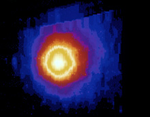
Apollo 17 had to come in between mountains and if you are to land at a lunar polar region it would be could to land near a dark crater but close to a sun lit mountain as well. Falling into a crater would not be a good thing if you weren't prepared for freezing cryogenic temperatures.
During the Lunar Prospector mission some 3D maps were presented to the viewers.
http://lunar.arc.nasa.gov/
There were lunar orbiters before the Apollo missions and we got to see much of the Moon.
http://www.lpi.usra.edu/
http://www.lpi.usra.edu/
We have moved on now and much more information will become available from the recent lunar orbiters.
[And I hope will be shared in an interactive way with the general public.]
http://news.bbc.co.uk/2/hi/
http://en.wikipedia.org/wiki/
http://nssdc.gsfc.nasa.gov/
http://www.moonposter.ie/
If (when) we go back to the Moon to stay we can use some updated versions of what has already been mapped.
http://www.lpi.usra.edu/
- LRK -
------------------------------------------------------------
http://www.nasa.gov/mission_
NASA's LRO Creating Unprecedented Topographic Map of Moon
[40 second video clip showing a full rotation of the Moon, before and now. - LRK -]A LOLA digital elevation map compiled in late 2009 (right) is compared to the Unified Lunar Control Network (ULCN) 2005, a painstakingly constructed map based on the best available data at the time, compiled by the U.S. Geological Survey. Credit: NASA/Goddard/MIT/SVS
[25 second animation of LOLA - LRK -]This is an animation illustrating how LOLA measures lunar elevations. LOLA sends a pattern of five laser pulses to the lunar surface, and computes distance and elevation by measuring how long it takes for the pulses to return. Credit: NASA/Goddard/Chris Meaney
"This dataset is being used to make digital elevation and terrain maps that will be a fundamental reference for future scientific and human exploration missions to the moon," said Dr. Gregory Neumann of NASA's Goddard Space Flight Center in Greenbelt, Md. "After about one year taking data, we already have nearly 3 billion data points from the Lunar Orbiter Laser Altimeter on board the LRO spacecraft, with near-uniform longitudinal coverage. We expect to continue to make measurements at this rate through the next two years of the science phase of the mission and beyond. Near the poles, we expect to provide near-GPS-like navigational capability as coverage is denser due to the spacecraft's polar orbit." Neumann will present the map at the American Geophysical Union meeting in San Francisco December 17.
The Lunar Orbiter Laser Altimeter (LOLA) works by propagating a single laser pulse through a Diffractive Optical Element that splits it into five beams. These beams then strike and are backscattered from the lunar surface. From the return pulse, the LOLA electronics determines the time of flight which, accounting for the speed of light, provides a precise measurement of the range from the spacecraft to the lunar surface. Range measurements, combined with accurate tracking of the spacecraft's location, are used to build a map revealing the contours of the lunar landscape. The five beams create a two-dimensional spot pattern that unambiguously reveals slopes. LOLA will also measure the spreading of the return pulse to get the surface roughness and the change in the transmitted compared to the return energy of the pulse to determine surface reflectance.
snip
[More discussion and images at link above. - LRK -]
------------------------------
On page below, links to above and more information links to LRO mission.
I like the first statement in Five Things to Know about LRO.
LRO is leading NASA’s way back to the moon.
- LRK -
------------------------------
http://www.nasa.gov/mission_
Lunar Reconnaissance Orbiter (LRO)
News and Features
LRO Creates New Lunar Topographic Map
http://www.nasa.gov/mission_
12.17.10
LRO is allowing researchers to create the most precise and complete map to date of the moon's complex, heavily cratered landscape. › Read More
http://www.nasa.gov/mission_
LRO Resources
› LRO Fact Sheet
› LRO Lithograph
› LRO/LCROSS Press Kit
Five Things to Know about LRO
[More links on the left and right side columns. - LRK -]
------------------------------
As noted at Space.com
- LRK -
------------------------------
http://www.space.com/
NASA Probe Maps Moon in Unprecedented Detail
By SPACE.com Staff
posted: 21 December 2010
12:10 pm ET
snip
[Note: Not happy with the pervasive "Chrome" browser pop up ad. - LRK -]
------------------------------
Hope we have similar information updates from other lunar spacecraft.
It would be helpful in determining if there might be resources useful to future explorers.
A good map to what is available and where to find it always helps.
- LRK -
Thanks for looking up with me.
- LRK -
Web Site: http://lkellogg.vttoth.com/
BlogSpot: http://kelloggserialreports.
RSS link: http://kelloggserialreports.
Newsletter: https://news.altair.com/
==============================
NASA's LRO Creating Unprecedented Topographic Map of Moon
12.17.10
NASA's Lunar Reconnaissance Orbiter is allowing researchers to create the most precise and complete map to date of the moon's complex, heavily cratered landscape.
NASA's Lunar Reconnaissance Orbiter is allowing researchers to create the most precise and complete map to date of the moon's complex, heavily cratered landscape.
[40 second video clip showing a full rotation of the Moon, before and now. - LRK -]A LOLA digital elevation map compiled in late 2009 (right) is compared to the Unified Lunar Control Network (ULCN) 2005, a painstakingly constructed map based on the best available data at the time, compiled by the U.S. Geological Survey. Credit: NASA/Goddard/MIT/SVS
[25 second animation of LOLA - LRK -]This is an animation illustrating how LOLA measures lunar elevations. LOLA sends a pattern of five laser pulses to the lunar surface, and computes distance and elevation by measuring how long it takes for the pulses to return. Credit: NASA/Goddard/Chris Meaney
"This dataset is being used to make digital elevation and terrain maps that will be a fundamental reference for future scientific and human exploration missions to the moon," said Dr. Gregory Neumann of NASA's Goddard Space Flight Center in Greenbelt, Md. "After about one year taking data, we already have nearly 3 billion data points from the Lunar Orbiter Laser Altimeter on board the LRO spacecraft, with near-uniform longitudinal coverage. We expect to continue to make measurements at this rate through the next two years of the science phase of the mission and beyond. Near the poles, we expect to provide near-GPS-like navigational capability as coverage is denser due to the spacecraft's polar orbit." Neumann will present the map at the American Geophysical Union meeting in San Francisco December 17.
The Lunar Orbiter Laser Altimeter (LOLA) works by propagating a single laser pulse through a Diffractive Optical Element that splits it into five beams. These beams then strike and are backscattered from the lunar surface. From the return pulse, the LOLA electronics determines the time of flight which, accounting for the speed of light, provides a precise measurement of the range from the spacecraft to the lunar surface. Range measurements, combined with accurate tracking of the spacecraft's location, are used to build a map revealing the contours of the lunar landscape. The five beams create a two-dimensional spot pattern that unambiguously reveals slopes. LOLA will also measure the spreading of the return pulse to get the surface roughness and the change in the transmitted compared to the return energy of the pulse to determine surface reflectance.
snip
[More discussion and images at link above. - LRK -]
------------------------------
I like the first statement in Five Things to Know about LRO.
LRO is leading NASA’s way back to the moon.
- LRK -
------------------------------
http://www.nasa.gov/mission_
Lunar Reconnaissance Orbiter (LRO)
News and Features
LRO Creates New Lunar Topographic Map
http://www.nasa.gov/mission_
12.17.10
LRO is allowing researchers to create the most precise and complete map to date of the moon's complex, heavily cratered landscape. › Read More
http://www.nasa.gov/mission_
LRO Resources
› LRO Fact Sheet
› LRO Lithograph
› LRO/LCROSS Press Kit
Five Things to Know about LRO
- LRO is leading NASA’s way back to the moon.
- The primary objective of LRO is to conduct investigations that prepare for future lunar exploration. Specifically LRO will scout for safe and compelling landing sites, locate potential resources (with special attention to the possibility of water ice) and characterize the effects of prolonged exposure to the lunar radiation environment. In addition to its exploration mission, LRO will also return rich scientific data that will help us to better understand the moon’s topography and composition.
- Seven scientific instruments outfit LRO. These instruments will return lunar imagery, topography, temperature measurements and more.
- Launched along with LRO was the Lunar CRater Observation and Sensing Satellite (LCROSS), a partner mission that will search for water ice on the moon.
- In response to LRO's "Send Your Name to the Moon" initiative, the spacecraft carries a microchip with nearly 1.6 million names submitted by the public. Click here to view a photo of the microchip containing the names as engineers prepare to install it on the spacecraft.
[More links on the left and right side columns. - LRK -]
------------------------------
- LRK -
------------------------------
http://www.space.com/
NASA Probe Maps Moon in Unprecedented Detail
By SPACE.com Staff
posted: 21 December 2010
12:10 pm ET
A NASA lunar probe's meticulous observations are allowing scientists to create the most precise and complete map of the moon's surface to date, researchers said.
In its first year or so of operation, NASA's Lunar Reconnaissance Orbiter (LRO) spacecraft beamed about 3 billion data points back to Earth, researchers said. And it's not done yet.
"This dataset is being used to make digital elevation and terrain maps that will be a fundamental reference for future scientific and human exploration missions to the moon," Gregory Neumann, of NASA's Goddard Space Flight Center in Greenbelt, Md., said in a statement. "We expect to continue to make measurements at this rate through the next two years of the science phase of the mission and beyond."
snip
[Note: Not happy with the pervasive "Chrome" browser pop up ad. - LRK -]
------------------------------
Hope we have similar information updates from other lunar spacecraft.
It would be helpful in determining if there might be resources useful to future explorers.
A good map to what is available and where to find it always helps.
- LRK -
Thanks for looking up with me.
- LRK -
Web Site: http://lkellogg.vttoth.com/
BlogSpot: http://kelloggserialreports.
RSS link: http://kelloggserialreports.
Newsletter: https://news.altair.com/
==============================
http://www.cbsnews.com/8301-
December 21, 2010 2:44 PM
No Green Cheese but Probe Maps Moon in Unprecedented Detail
No Green Cheese but Probe Maps Moon in Unprecedented Detail
Posted by CBSNews.com
This story originally appeared on space.com A NASA lunar probe's meticulous observations are allowing scientists to create the most precise and complete map of the moon's surface to date, researchers said.
This story originally appeared on space.com A NASA lunar probe's meticulous observations are allowing scientists to create the most precise and complete map of the moon's surface to date, researchers said.
In its first year or so of operation, NASA's Lunar Reconnaissance Orbiter (LRO) spacecraft beamed about 3 billion data points back to Earth, researchers said. And it's not done yet.
"This dataset is being used to make digital elevation and terrain maps that will be a fundamental reference for future scientific and human exploration missions to the moon," Gregory Neumann, of NASA's Goddard Space Flight Center in Greenbelt, Md., said in a statement. "We expect to continue to make measurements at this rate through the next two years of the science phase of the mission and beyond."
Neumann presented the lunar map at the American Geophysical Union meeting on Dec. 17. [Photo of the new map]
snip
==============================
http://www.lpi.usra.edu/
Lunar Topographic Maps
References
http://www.lpi.usra.edu/
Feature Names
http://www.lpi.usra.edu/
snip
==============================
WHAT THE MIND CAN CONCEIVE, AND BELIEVE, IT WILL ACHIEVE - LRK
==============================
==============================
http://www.lpi.usra.edu/
Lunar Topographic Maps
References
http://www.lpi.usra.edu/
Feature Names
http://www.lpi.usra.edu/
snip
==============================
WHAT THE MIND CAN CONCEIVE, AND BELIEVE, IT WILL ACHIEVE - LRK
==============================