India Approves Moon Mission: "India Approves Moon Mission
By K.S. Jayaraman
Special to SPACE.com
posted: 04:15 pm ET
19 August 2003"
NEW DELHI, India -- India will send a spacecraft to the moon by 2008, prime minister Atal Behari Vajpayee said in his Independence Day address to the nation Aug. 15. The announcement has put an end to suspense over the fate of the roughly $100 million project of the Indian Space Research Organization (ISRO) that was waiting for a formal sanction for over eight months.
The mission -- named Chandrayan-1 -- foresees placing a 1150 lb. (525 kilogram) satellite in a polar orbit 62 miles (100 kilometers) above the moon. The spacecraft will be launched by a modified version of India’s indigenous Polar Satellite Launch Vehicle. The lunar orbiter will be designed to operate for two years.
"This mission will provide a unique opportunity for frontier scientific research," ISRO said in a statement. "It is expected to be the forerunner of more ambitious planetary missions in the years to come, including landing robots on the moon and visits by Indian spacecraft to other planets in the solar system."
Chandrayan-1’s aim, according to the study group that recommended the mission, is to obtain a chemical map of the entire lunar surface. The data from the mission will be used to create a 3-dimensional atlas of regions of interest using high-resolution remote sensing in the visible, near infrared, low and high-energy X-ray regions.
Observations using the X-ray spectrum and stereographic coverage of most of the moon’s surface at a ground resolution of 5 meters is designed to provide new insight in understanding lunar surface processes, according to ISRO. The areas selected for a focused study are the north and south polar regions (believed to contain ice) and the lunar South Pole’s Aitken basin -- an ancient crater impact area.
At the end of the mission ISRO expects to provide the scientific community an improved model of the moon’s gravity. This would be made possible with the highly accurate measurements of moon’s topography by a lunar laser ranging instrument and the digital elevation model derived from 3-D imageries obtained by the terrain mapping stereo camera.
---
From Space.com
- LRK -
skip to main |
skip to sidebar

- LRK -

Vision

Moon Mars & Beyond
Pioneer Venus Views in UV

Mr. K
- LRK -
To The Moon, Mars, and Beyond
Many folks would like to see us back on the Moon and developing its resources.
A Vision For Space
Vision
Moon, Mars & Beyond
Moon Mars & Beyond
Blog Archive
-
▼
2003
(196)
-
▼
October
(37)
- Bush May Announce Return To Moon At Kitty Hawk: "B...
- Latest News for the Low Dose Radiation Research Pr...
- 13March 1989 - Solar CME Storm: "SUNSTORMS and SPA...
- The Phantom Torso: "The Phantom Torso An unusual s...
- Optical Physics: "Light Beams in High-Order Modes ...
- NASA's History Office: Hot Topics/FAQs- New Public...
- NEO Tools For The Observer: "JPL's Solar System Dy...
- Orbit for Hermes Dynamically Linked from 1937 to 2...
- BBC NEWS | Science/Nature | Rock lost in space for...
- Lost & Found: Near-Earth Asteroid Spotted after 66...
- Prime Minister Announces Mission to Moon: "Prime M...
- GSLV - Summary: "GSLV - Summary The Geosynchronou...
- India: Aerospace Sources >Spaceflight: "India: Aer...
- Welcome to Indian Space Research Organisation: "Th...
- Earth Imaging Spacecraft Launched by India's PSLV:...
- India Approves Moon Mission: "India Approves Moon ...
- Gunter's Space Page - Information on Launch vehicl...
- ALSEP - General: "Experiment Operations During Apo...
- 4Reference || Variable specific impulse magnetopla...
- China Successfully Completes First Manned Space Fl...
- Variable-Specific-Impulse Magnetoplasma Rocket: "V...
- Spaceflight Now | Shenzhou Launch Report | First C...
- China puts man into orbit to join elite space club...
- Space Calendar (JPL): "Oct 13 - Comet C/2003 K4 (L...
- BIS Spaceflight - News: "Latest News: Brazil hold...
- The British Interplanetary Society: "'From imagina...
- BIS Spaceflight - Space Chronicle: "The first JBIS...
- NSSDC Master Catalog: Spacecraft: "Launch Date/Tim...
- ESA - SMART-1 - The SMART way to travel: "9 July 2...
- Address at Rice University on the Nation's Space E...
- Space Settlement: "Online Space Settlement Books...
- Celestia: A 3D Space Simulator: "Celestia is a fre...
- The Industrial Physicist: "April/May 2002 Volume 8...
- Getting Power From The Moon: "Getting Power From T...
- University of Houston - Collegium: "UH's Man on th...
- SciScoop || Comments Space Solar Power for Moon an...
- Isaac Asimov and Space Exploration: "'Our Future i...
-
▼
October
(37)
Links I Like
- 50 Places to Explore Outer Space Online
- Advanced Nanotechnology
- Astronomy Picture of the Day
- Beyond Apollo
- Beyond Earth
- Centauri Dreams
- CoEvolutionBook-TOC
- Colony Worlds
- Daily Galaxy: News from Planet Earth & Beyond
- Dark Roasted Blend
- Develop Space net
- FLORIDA SPACErePORT
- FUTURE SPACE
- Fantastic Fiction - UK
- Goflight * org
- High-Flight * org
- Hobbyspace * com
- Honeysuckle Creek
- Hyperbola
- IEC Fusion Technology blog
- ISRO Indian Space Research Organisation
- KSU News Letter
- LPOD Lunar Photo Of Day
- LUF - Blog
- Lunar Archive
- Lunar Explorers
- Lunar Networks
- Lunar Pioneer
- Lunar Update
- Moon Society org
- Moon Today * net
- Moon Views
- MoonAndBack
- NASA History Series Publications
- NASA Office of Logic Design - OLD
- NASA Space Flight
- NASA Space Information, Shuttle, ISS
- NASA Space Shuttle Information
- NASA Spaceflight Gallery
- NASA Watch
- NASA-Image Blog
- NSS - Space Settlement
- NSS Lunar Base & Settlement Library
- National Geographic Channel
- New Space Journal
- Nicholas G Carr
- Night Sky Network
- OnOrbit
- Out Of The Cradle
- Planetary Society
- Political Action For Space
- Rocket & Space Technology
- Science Fiction & Reading Experience
- Space Fellowship
- Space Politics
- Space Renaissance Initiative
- Space Station-Shuttle blog
- Space Today net
- SpaceStationInfo
- Spaceflight Now
- Spaceport America
- Spinor Info
- TED/Talks/List
- The Conquest of Space
- The Moon Society
- The Shutle Era
- The Space Review
- The X-Ray Vision-aries Blog
- Transient Lunar Phenomena Studies
- WRITE SCIENCE
- denniswingo
Search
Loading...
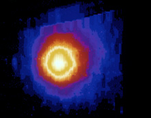
Halley"s Comet AC86-0107-5
Pioneer Venus Views in UV
Past Research of Comets
http://www.nasa.gov/centers/ames/multimedia/images/2005/comets1.html
Photo No. AC86-0107-5 – Halley's Comet, Ultra Violet Hydrogen emission (reddish circular band).
No comments:
Post a Comment
Note: Only a member of this blog may post a comment.