Los Alamos releases new maps of Mars water:
Los Alamos releases new maps of Mars water
Contact: Nancy Ambrosiano, nwa@lanl.gov, (505) 667-0471 (03-101)
Contact: Jim Danneskiold, jdanneskiold@lanl.gov, (505) 667-1640
"LOS ALAMOS, N.M., July 24, 2003 -- 'Breathtaking' new maps of likely sites of water on Mars showcase their association with geologic features such as Vallis Marineris, the largest canyon in the solar system.
The maps detail the distribution of water-equivalent hydrogen as revealed by Los Alamos National Laboratory-developed instruments aboard NASA's Mars Odyssey spacecraft. In an upcoming talk at the Sixth International Conference on Mars at the California Institute of Technology, in Pasadena, Los Alamos space scientist Bill Feldman and coworkers will offer current estimates of the total amount of water stored near the Martian surface. His presentation will be at 1:20 p.m., Friday, July 25.
For more than a year, Los Alamos' neutron spectrometer has been carefully mapping the hydrogen content of the planet's surface by measuring changes in neutrons given off by soil, an indicator of hydrogen likely in the form of water-ice. The new color maps are available at http://www.lanl.gov/worldview/news/photos/mars.shtml online.
'The new pictures are just breathtaking, the water-equivalent hydrogen follows the geographic features beautifully,' said Feldman. 'There's a lane of hydrogen-rich material following the western slopes of the biggest volcanoes in the solar system, a maximum reading sits right on Elysium mons, and another maximum is in the deepest canyon in the solar system.'"
snip
skip to main |
skip to sidebar

- LRK -

Vision

Moon Mars & Beyond
Pioneer Venus Views in UV

Mr. K
- LRK -
To The Moon, Mars, and Beyond
Many folks would like to see us back on the Moon and developing its resources.
A Vision For Space
Vision
Moon, Mars & Beyond
Moon Mars & Beyond
Blog Archive
-
▼
2003
(196)
-
▼
August
(43)
- LUNAR SOLAR POWER SYSTEM FOR ENERGY PROSPERITY WIT...
- LUNAR SOLAR POWER SYSTEM FOR ENERGY PROSPERITY WIT...
- LPI Abstracts: " ABSTRACTS Lunar and Planetary Sci...
- SIRTF: "Update: 27 August 2003 This is Day 3 of th...
- NASA - NASA Administrator Accepts Columbia Acciden...
- NASA - Columbia - Home: " The Columbia Accident ...
- KSC Release No. 76-03: "Donald Savage ...
- Pluto Mission May Be Early Victim Of Growing Budge...
- Failure Is Not An Option FAILURE IS NOT AN OPTION...
- I S A S / Public Outreach: "Ion Engine Operation o...
- I S A S / Public Outreach: "International Joint Me...
- TransOrbital's TrailBlazer Private space satellite...
- TransOrbital, Inc. - TrailBlazer - Mission: "Trail...
- CNN.com - Moon probe to map 'Peak of Eternal Light...
- India Approves Moon Mission: "India Approves Moon ...
- BBC NEWS | Science/Nature | Moon colony 'within 20...
- Visiting Chabot Space & Science Center: "Surround ...
- Exhibits at Chabot: Mars Encounter: "Mars Encounte...
- Exhibits at Chabot Space & Science Center: "New ex...
- Astrofuel�Energy Source of the Future: Astrofuel—...
- PM goofs up on India's moon mission - Sify.com: " ...
- US blackout: Indian wins kudos for meals - Sify.co...
- The Tribune, Chandigarh, India - Main News: "Moon ...
- BBCi - The Sky at Night - Watch Online: "THE SKY A...
- The Space Review: Considering the fate of Hubble (...
- Idlewild: " Nick Sagan Read by Clayton Barclay J...
- TCS: Enviro-Sci - Sagan Reloaded: "Sagan Reloaded ...
- TCS: Enviro-Sci - Eyes on the X-Prize: "Eyes on th...
- Transterrestrial Musings: "Biting Commentary About...
- FOXNews.com: " Thursday, August 14, 2003 By Rand S...
- ROBOCAMP GRADUATION SHOWCASES STUDENTS� NEW ROBOTI...
- Press Releases: "ORBITAL'S PEGASUS ROCKET SUCCESSF...
- Apollo 16 Flight Journal - Index Page: "Welcome to...
- China plans to send robot to the moon in 20 years:...
- Shenzhou-5 Launcher Ready For Transfer To Jiuquan ...
- Do Martian Bugs Have Any Intrinsic Rights: "MARSDA...
- China's First Lunar Steps: "China's First Lunar St...
- BBC NEWS | Science/Nature | China's first astronau...
- Development of China's Aerospace Industry during t...
- Imagiverse.Org 2nd Anniversary: "Imagiverse.Org 2n...
- Press Release, 11 April 2003: "Mars Rover Landing ...
- Los Alamos releases new maps of Mars water: ...
- JPL News Release - Intriguing Celestial Images Arr...
-
▼
August
(43)
Links I Like
- 50 Places to Explore Outer Space Online
- Advanced Nanotechnology
- Astronomy Picture of the Day
- Beyond Apollo
- Beyond Earth
- Centauri Dreams
- CoEvolutionBook-TOC
- Colony Worlds
- Daily Galaxy: News from Planet Earth & Beyond
- Dark Roasted Blend
- Develop Space net
- FLORIDA SPACErePORT
- FUTURE SPACE
- Fantastic Fiction - UK
- Goflight * org
- High-Flight * org
- Hobbyspace * com
- Honeysuckle Creek
- Hyperbola
- IEC Fusion Technology blog
- ISRO Indian Space Research Organisation
- KSU News Letter
- LPOD Lunar Photo Of Day
- LUF - Blog
- Lunar Archive
- Lunar Explorers
- Lunar Networks
- Lunar Pioneer
- Lunar Update
- Moon Society org
- Moon Today * net
- Moon Views
- MoonAndBack
- NASA History Series Publications
- NASA Office of Logic Design - OLD
- NASA Space Flight
- NASA Space Information, Shuttle, ISS
- NASA Space Shuttle Information
- NASA Spaceflight Gallery
- NASA Watch
- NASA-Image Blog
- NSS - Space Settlement
- NSS Lunar Base & Settlement Library
- National Geographic Channel
- New Space Journal
- Nicholas G Carr
- Night Sky Network
- OnOrbit
- Out Of The Cradle
- Planetary Society
- Political Action For Space
- Rocket & Space Technology
- Science Fiction & Reading Experience
- Space Fellowship
- Space Politics
- Space Renaissance Initiative
- Space Station-Shuttle blog
- Space Today net
- SpaceStationInfo
- Spaceflight Now
- Spaceport America
- Spinor Info
- TED/Talks/List
- The Conquest of Space
- The Moon Society
- The Shutle Era
- The Space Review
- The X-Ray Vision-aries Blog
- Transient Lunar Phenomena Studies
- WRITE SCIENCE
- denniswingo
Search
Loading...
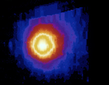
Halley"s Comet AC86-0107-5
Pioneer Venus Views in UV
Past Research of Comets
http://www.nasa.gov/centers/ames/multimedia/images/2005/comets1.html
Photo No. AC86-0107-5 – Halley's Comet, Ultra Violet Hydrogen emission (reddish circular band).
No comments:
Post a Comment
Note: Only a member of this blog may post a comment.